
Victorian 3D Digital Cadastre Investigation
Land Services Victoria registers 3D building subdivisions using a paper/PDF based approach. Since 2014, it has been investigating the requirements for developing a 3D digital cadastre consistent with the 'ICSM Cadastre 2034 Strategy' . A 3D digital cadastre includes technical, legal and institutional aspects. The following technical requirements are currently being investigated:
- 3D data modelling
- 3D data validation
- 3D data visualisation
- 3D data storage
This information sheet provides a summary of the recent investigations.
3D Data Modelling
In terms of the data modelling investigation, the ePlan data model has been assessed in the following three phases to determine how it may handle different scenarios of building subdivisions in Victoria. At the same time, other alternatives (e.g. Building Information Modelling (BIM)) are also being considered.
The investigation results have been published in an article entitled 'Assessment of the Australian digital cadastre protocol (ePlan) in terms of supporting 3D building subdivisions' in Volume 56 of the Journal of Land Use Policy. To access this article, please click here.
Phase 1
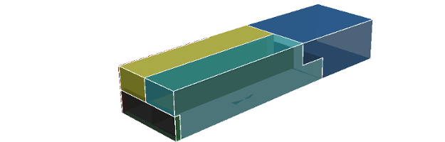
A simple building subdivision plan (including 3 lots, 1 common property and 1 easement) was chosen and possible approaches for modelling 3D parcels in ePlan were studied. The results of the study were presented to the ICSM ePlan Technical Committee at a workshop in Melbourne in August 2014 and the participants agreed on the 'Referencing Approach' as the best to pursue. In this approach, the common objects between different parcels (e.g. walls, ceilings, etc.) are defined once and used multiple times. This approach maintains the topology of 3D data and avoids data redundancy.
(Source: Shojaei et al., 2012)
Phase 2
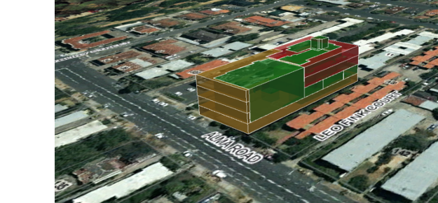
A regular shape building subdivision plan (including 12 lots and 2 common properties) was chosen. A 3D model of this plan was prepared in accordance with the BIM concept and contains 3D ownership rights for the existing lots and common properties. This model was successfully converted into the ePlan format. The results of the second phase confirmed that the selected ePlan modelling approach is suitable for regular shape buildings.
Phase 3
Modelling of irregularly shaped buildings in the ePlan Protocol was investigated in this phase. Various irregular shapes such as cylinder, cone, donut and sphere as well as a building subdivision with curved surfaces were chosen in this phase to test the ePlan Protocol 3D modelling capability. The study confirmed that the curved surfaces need to be approximated by flat faces in the ePlan Protocol.
3D Data Validation
Data ambiguity and invalidity can cause significant expensive issues in the cadastral domain (e.g. legal disputes). Therefore, automated data validation can significantly help to reduce the potential issues. Quality assurance has been comprehensively investigated in various domains, however, the validation of 3D cadastral data is still in its infancy and has only recently started to develop. The availability of various regular and irregular shapes for 3D cadastral objects and modern building designs has resulted in a critical need for developing validation rules to ensure data validity and quality.
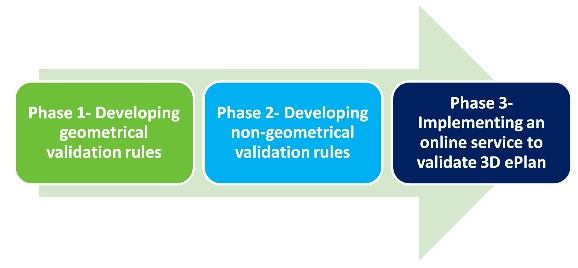
3D data validation investigation is being undertaken in three main phases including:
- developing geometrical validation rules
- developing non-geometrical validation rules
- implementing an online service to validate 3D ePlans
Figure below illustrates the phases defined for 3D data validation investigation.
Phase one of this study is currently under investigation. Four geometrical validation rules have been formalised using mathematical expressions to check the individual 3D parcels and their relationships with adjoining or neighbouring parcels. The first validation rule checks the compatibility of the subdivided parcel against the created parcels. The second rule ensures the faces forming a 3D parcel are flat. The third rule assures 3D objects are watertight and the fourth deals with parcel collision detection which is required for flagging unacceptable intersection of 3D objects.
The investigation results have been published in an article entitled ‘Geometrical data validation in 3D digital cadastre − A case study for Victoria, Australia’ in Volume 68 of the Journal of Land Use Policy. To access this article, please click here.
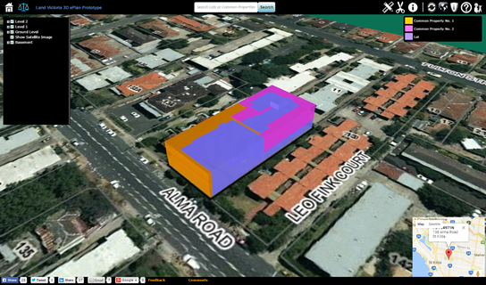
3D Data visualisation
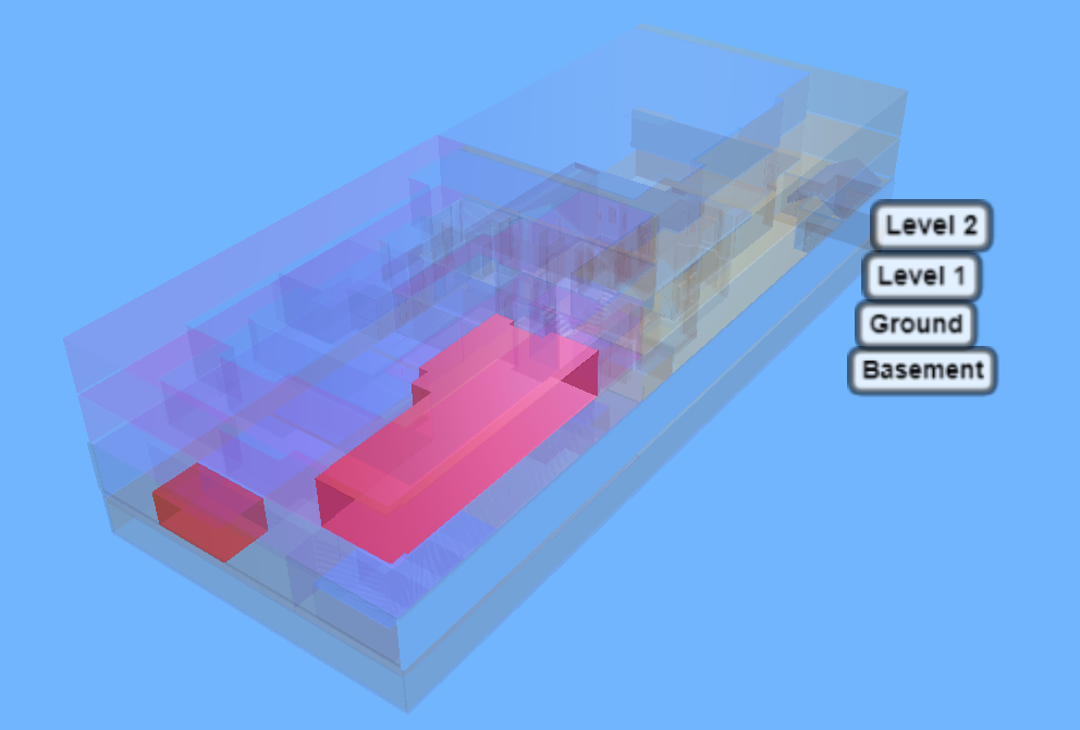
An interactive prototype has been developed which illustrates how the legal and physical objects of a building subdivision plan can be stored, visualised and queried in a 3D web-based visualisation application. The prototype has received positive feedback, nationally and internationally. The second version of the prototype is currently being evaluated by various stakeholders. The result of this study will be published in due course. This prototype is available on the SPEAR website.
3D Data Storage
As part of this research, several databases were assessed with Oracle selected as the most suitable, based on its high performance in storing, retrieving and analysing spatial data. Currently, the Oracle database is used in SPEAR for storing registered 2D ePlans.
The next phase is designing and implementing an approach in Oracle to store the 3D cadastral data. The results of this research will significantly help develop the appropriate databases to efficiently manage 3D Rights, Restrictions and Responsibilities (RRRs) for a 3D cadastre.