
ePlan Overview
ePlan is a digital data file in LandXML data format which represents cadastral and administrative information related to a plan. ePlan improves data quality, minimises duplication, and paves the way for end-to-end digital data workflows throughout the lifecycle of a plan. This enables streamlining and automation of existing manual processes for faster, reliable, and consistent plan registration.
Information about the ePlan mandate is available on the Land.Vic website.
ePlan training and support resources are available below or contact us for assistance in preparing an ePlan and using the ePlan Portal.
ePlan exemptions
SCFF/ePlan process is for plans under the Subdivision Act 1988 only. Currently ePlan does not support the following plan features:
- Cross-section (created parcel)
- Text-only plans
- Variations of restrictions
- Any plan which affects unnumbered common property, or land contained in an unnumbered owners corporation
Plans with these features are not subject to the ePlan mandate.
ePlan minimum information requirements
ePlan data requirements are listed in the attached DOCX, together with a mock up of an Abstract of Field Record and Plan, which differentiate between mandatory and optional data elements.
Useful ePlan related material listed below:
External related material listed below:
The data contained in an ePlan includes:
- survey measurements and parcel dimensions
- easement, road and reserve information
- land parcel descriptions and identifiers
- administrative information
- owner's corporation schedules, and more
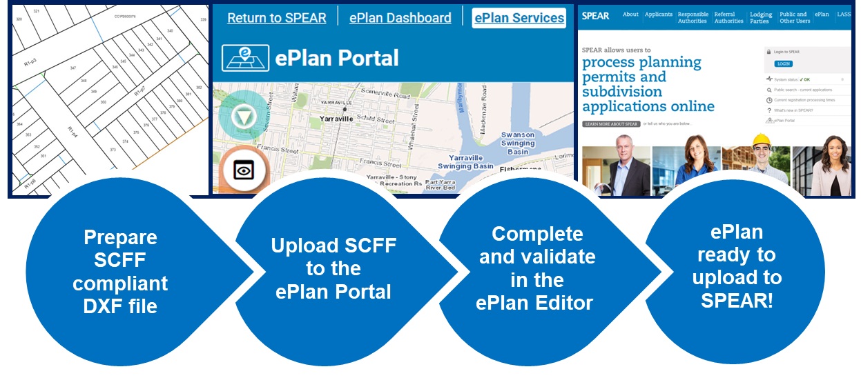
Surveyors create ePlan using the SCFF methodology, which uses a DXF CAD file as the basis for providing plan and survey geometries. The SCFF is converted to ePlan using the ePlan Portal and its associated services which validate the ePlan and allow for additional administrative data to be supplied (for example, easement information). The following ePlan tools and services are available from the ePlan Portal and described in more detail in the ePlan FAQs.
- ePlan Dashboard
- ePlan Editor
- SCFF Validation Service
- ePlan Validation Service
- ePlan Validation Report
- Plan Visualisation Service
- ePlan Visualisation Enhancement Tool
Used collectively the ePlan Portal and its services provide the interface to allow a surveyor to upload and validate their SCFF and produce an ePlan that can be used in new or existing SPEAR applications.
All Applicant Contact SPEAR users can access the ePlan portal once they have logged into SPEAR.
For more information, please refer to the Getting Started: Training Resources section under the ePlan menu.